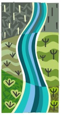
Exploring Landforms
In this unit, the children explore physical geography and remote sensing through data collection and computer generated landform mapping. We begin the unit with an examination of contour maps, microclimates and landform analysis, then transition to the main part of the unit that investigates remote sensing through the creation of an individual “landform in a box” and Excel mapping project.
Every student designs and builds a landform, made from news print which is held together by salt/flour glue and built within a shoebox. After each student constructs and paints their landform, they write a descriptive account and draw a landscape portrait depicting what it would be like to wander through their landscape. The students then seal the box, glue a piece of graph paper to the top and trade it with another member of the grade.
When the recipients receive the mystery box, they systematically poke holes in the lid to probe and measure the relief of the landform. Members then create a spreadsheet of elevation data. When the children finish their spreadsheets, they will each create a contour map showing elevation and read the donor's description/illustration. This unit also has a great technology component because everyone enters their data on Excel to make a series of spectacular 3-D computer graphs complete with color scheme selections to make every virtual landform come to life!
To finish the unit and celebrate its success, the recipients will open the box to unveil the real landform! In the same manner that satellite controllers use RADAR to map elevation, and submariners use SONAR to map the ocean floor, the students use remote sensing techniques to map and visualize something that they cannot directly see. At end of the exercise, each student will be reunited with their original box and take home the souvenir maps and graphs.
Focus
• Make/use contour maps
• Create remote sensing land form boxes
• Probe other boxes and create tables and maps from the data collected, using Excel
• Become proficient in manipulating many Excel graph functions while creating a 3-D image of their landform
• Create supplemental illustrations and written descriptions for their landforms
Websites to Explore on the Topic:
Landforms by SKC
Surface of the Earth landform photos by National Geographic
Interactive Map Landform regions of the United States by Houghton Mifflin Co.
Enchanted Learning Landforms and Bodies of Water
Harcourt - Types of Land
Quia Landform Vocabulary practice